State Maps Home > State Map Collection > Colorado Springs Map
Road Map of Colorado Springs
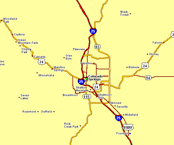
On top you have a simple diagram setting out the geography of this area of interest with a classic medley of elements.
You can share this web page and utilize it in your work. Giving credit to this webpage would be helpful.
In the case that you are looking for support retrieving a map, a distinct kind of map, or are looking for a proper personalized map, quickly email us.
Purchase high quality specially made maps from us. Our custom maps provide a good array of map components, such as: backroads, scale bar, coordinates, channels, lakes, unincorporated areas, craters, or recreational sites, etc. Map types range from cultural to land use, digital to hardcopy, world to ZIP code tabulation areas.
Proper maps are meticulous, elaborate, and not misleading. Skillful cartography by YellowMaps.
To procure physical maps, like road atlases, country maps, or topographic maps, you can go to YellowMaps Map Store We carry over 100,000 maps.
Ever wondered why there are so many different maps around? Well, to cover the whole of North America at let's say 1:24,000 scale, you will need more than 100,000 maps. This would be millions of maps if you want to cover the whole earth at that scale. It's a big place!
Back to State map collection