State Maps Home > State Map Collection > Northwestern Colorado Map
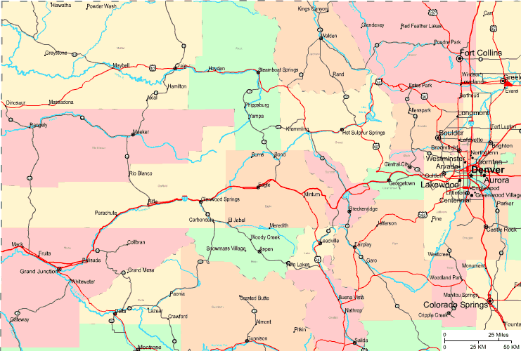
Highway Map of Northwestern Colorado

On top we have a classic map setting out the spatial layout of this neighborhood with a plain selection of elements.
You may always store this map and employ it in your projects. Giving credit to this webpage would be awesome.
On the assumption that you wish for help finding a map, a different kind of map, or wish for a great tailor-made concoction, just email YellowMaps.
Purchase good custom maps from us. Our custom maps have a wide array of map components, in detail: trails, map projection, coordinate grid, caves, indian reserves, sea features, falls, or plains, etc. Map types run from highway to satellite, static to dynamic, block groups to congressional districts.
Great maps are detailed, complete, and not misleading. Detail-Oriented cartography by YellowMaps.
To purchase printed maps or charts, such as backroad mapbooks, attractions maps, or hiking maps, quickly pay a visit to YellowMaps Map Store It has tens of thousands products.
We like to help you. If you have any questions, please do ask! We are very friendly :D
Back to State map collection