State Maps Home > State Map Collection > Southwestern Colorado Map
Highway Map of Southwestern Colorado
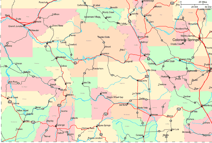
The map above is a classic projection presenting the features of this neck of the woods with a simple selection of elements.
You can download the map and take advantage of it in your research. Providing a link to here would be helpful.
Supposing you desire help retrieving a map, a distinct kind of map, or desire a first-class tailor-made product, quickly get in touch with us.
Buy proper personalized maps from us. A custom map made by us consist of a large diversity of details, such as: streets, legend, GPS coordinates, campsites, marine navigation features, shoals, glaciers, or recreational sites, etc. Map types range from trail to tourist, printable to printed, census tracts to consolidated cities.
First-Class maps are clear, current, and not obsolete. First-Rate map-making by YellowMaps.
To acquire hardcopy maps, such as wall maps, tourist maps, or topo maps, simply explore our map store It has more than 100,000 maps.
Ever wondered why there are so many different maps around? Well, to cover the whole of North America at let's say 1:24,000 scale, you will need more than 100,000 maps. This would be millions of maps if you want to cover the whole earth at that scale. It's a big place!
Back to State map collection