State Maps Home > State Map Collection > Colorado Map
Printable Map of Colorado
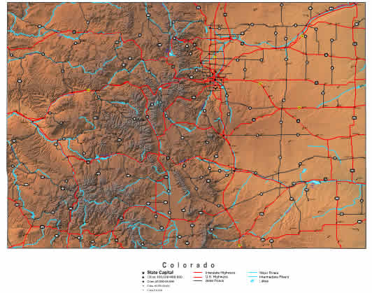
Above is a classic figure sporting the geography of this area with a plain diversity of map components.
You can download this image and work with it in your work. Providing a link to here is considerate and well thought of.
In case you require assistance acquiring a map, a special kind of map, or require a first-rate tailor-made cartographic design, simply get in touch with us.
Buy good custom maps from us. Our custom maps provide a good collection of map components, such as: expressways, scale bar, coordinates, campsites, military area, villages, forests, or rapids, etc. Map types run from street to city, navigation to general reference, state or province to urban growth areas.
First-Rate maps are detailed, current, and not unclear. Fine map production by YellowMaps.
To buy hardcopy maps, like road atlases, folded maps, or maps for canoeing, please browse our map shop We carry more than 100,000 products.
Maps are just so interesting.
Back to State map collection