State Maps Home > State Map Collection > Kansas Large Map
Printable Map of Kansas Large
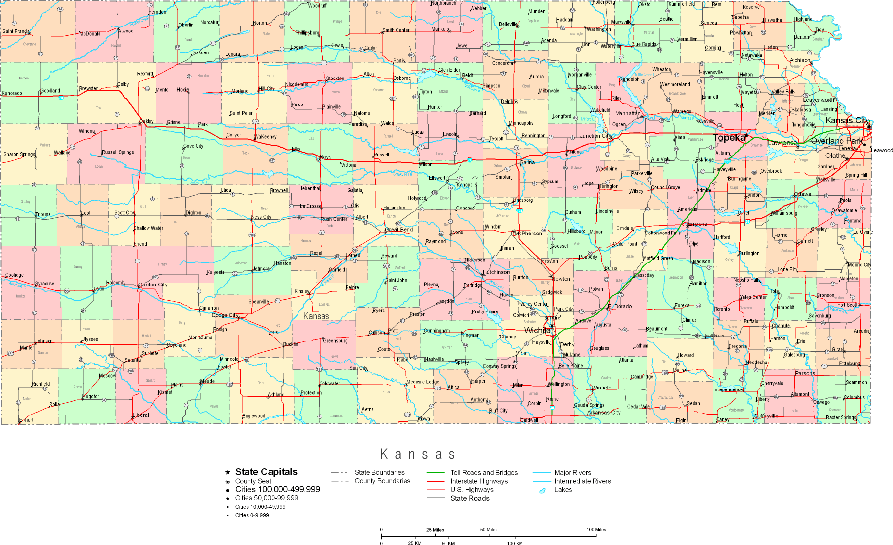
The above is a plain graph showing the political boundaries of this area of interest with a basic collection of elements.
You are allowed to use the map and employ it for a variety of purposes. Giving credit to this webpage would be helpful.
In case you want help finding a map, a special kind of map, or want a high quality custom preparation, just email us.
Buy good custom maps from us. Cuztomized maps by YellowMaps embrace a generous variety of details, for example: alleys, legend, coordinate grid, beaches, major agglomeration areas, seas, cliffs, or rapids, etc. Types of maps run from topographic to satellite, printable to printed, national to state legislative districts.
High Quality maps are accurate, current, and not obsolete. Expert cartography by YellowMaps.
To purchase printed maps or charts, for example wall maps, maps for kids, or maps for canoeing, please explore our map store We have a collection of tens of thousands products.
We love maps. A grand passion and delight. Show me a good map of the world..., they say.
Back to State map collection