State Maps Home > State Map Collection > Maryland Large Map
Printable Map of Maryland Large
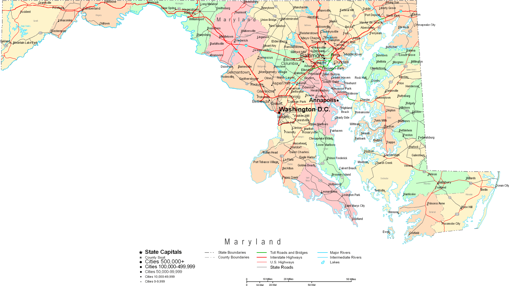
Above is a basic sketch setting out the spatial layout of this region with a simple diversity of elements.
You can store the map and make use of it in your work. Providing a link to here would be our request.
In case you call for assistance retrieving a map, a special kind of map, or call for a great customized preparation, you can contact YellowMaps.
Order good custom maps from us. Custom maps made by YellowMaps encompass a wholesome assortment of elements, in detail: trails, map projection, coordinate grid, bays, major agglomeration areas, springs, falls, or railway features, etc. Map types run from general reference to wall, navigation to general reference, electoral district to estates.
Great maps are succinct, up to date, and not misleading. Expert map design by YellowMaps.
To acquire hardcopy maps, for example wall maps, maps of continents, or maps for exploring, please marvel at the cartographic delights in YellowMaps Map Store We hold more than 100,000 maps.
Ever wondered why there are so many different maps around? Well, to cover the whole of North America at let's say 1:24,000 scale, you will need more than 100,000 maps. This would be millions of maps if you want to cover the whole earth at that scale. It's a big place!
Back to State map collection