State Maps Home > State Map Collection > Massachusetts Large Map
Printable Map of Massachusetts Large
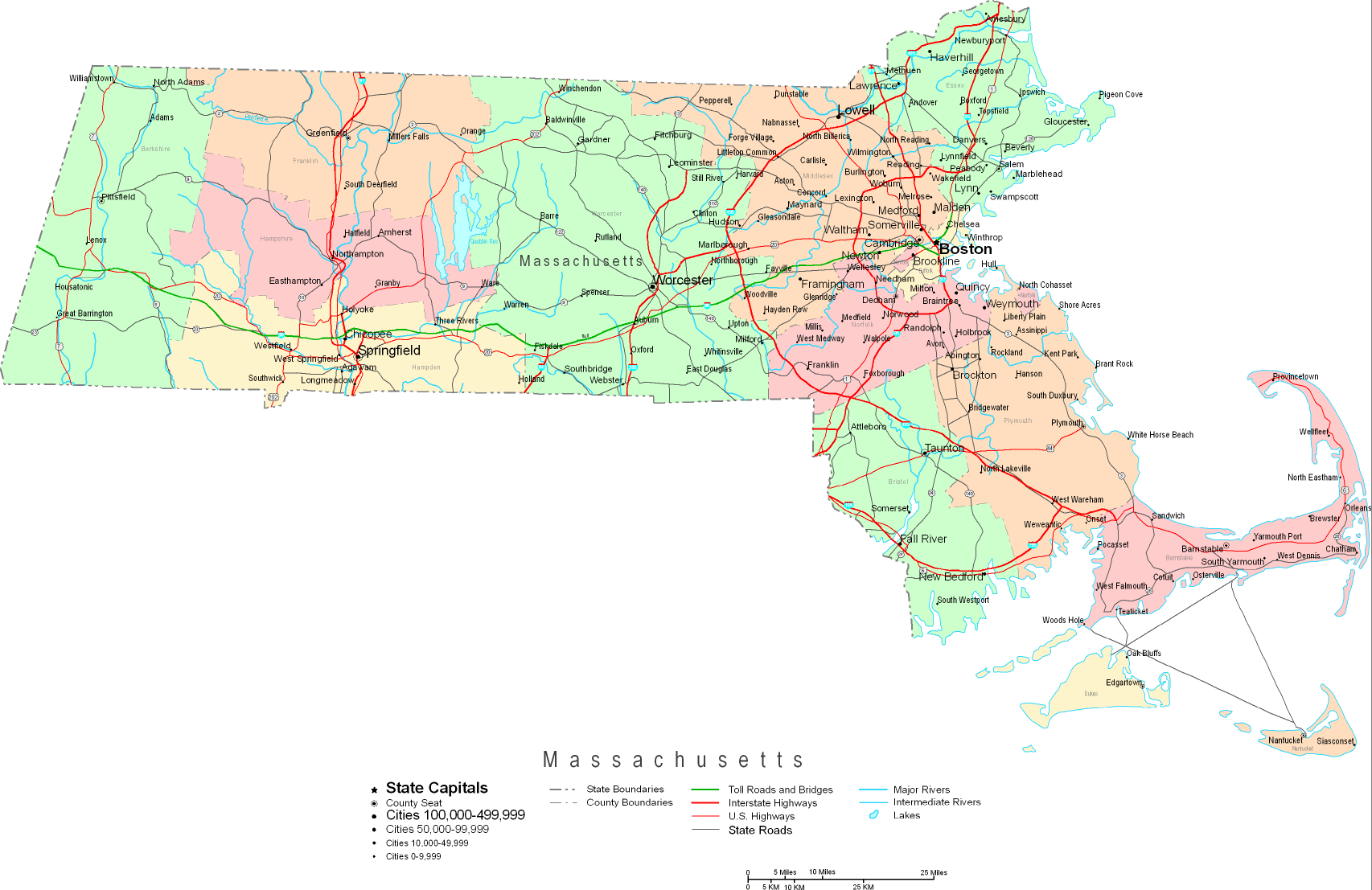
Above is a classic map brandishing the geography of this neck of the woods with a basic combination of details.
You are granted permission to use the map and take advantage of it in your research. Citing this page is always appreciated. Thank you kindly.
If you are looking for support retrieving a map, a special kind of map, or are looking for a good tailor-made work, do not hesitate to contact us.
Acquire nice custom-built maps from us. A custom map made by us provide a large diversity of elements, such as: routes, map projection, coordinates, caves, marine navigation features, sea features, craters, or recreational sites, etc. Map types reach from street to city, digital to hardcopy, counties to urban areas.
Good maps are precise, well-defined, and not unclear. Fine map-making by YellowMaps.
To buy physical maps, like wall maps, maps for kids, or topographic maps, you can marvel at the cartographic delights in our online map shop It contains thousands and thousands map products.
We love maps. A grand passion and delight. Show me a good map of the world..., they say.
Back to State map collection