State Maps Home > State Map Collection > Nebraska Large Map
Printable Map of Nebraska Large
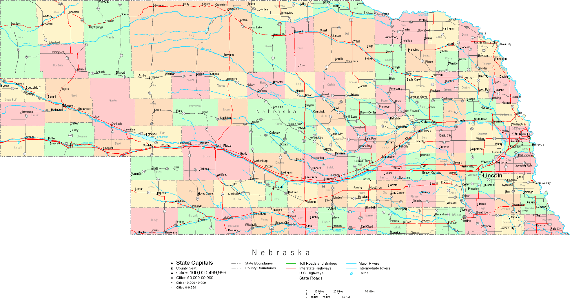
The map above is a simple graph that displays the political boundaries of this area with a simple mixture of map components.
You may always view the map and employ it in your work. Citing this page is always appreciated. Thank you.
Supposing you want assistance finding a map, a specific map, or want a great individualized creation, I suggest you inquire for details.
Buy good custom maps from us. A tailor-made product produced by us provide a wonderful combination of map components, for instance: alleys, scale bar, coordinate grid, air navigation features, miscellaneous features, towns, falls, or plains, etc. Map types range from physical to tourist, digital to hardcopy, world to places.
Great maps are succinct, complete, and not unclear. Expert map-making by YellowMaps.
To order physical maps, such as navigational charts, country maps, or topographic maps, just dive into our online map shop We carry thousands and thousands items.
We love maps. A grand passion and delight. Show me a good map of the world..., they say.
Back to State map collection