State Maps Home > State Map Collection > Utah Reference Map
Printable Map of Utah Reference
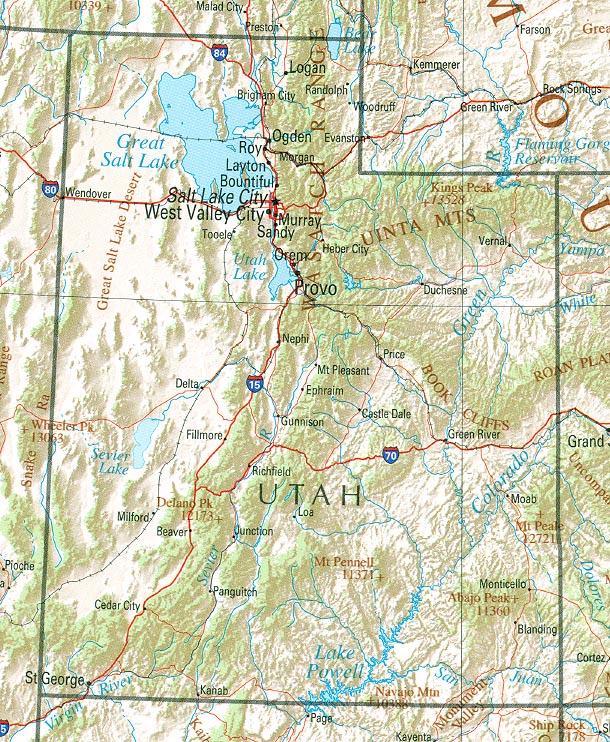
Above is a plain depiction that lays out the features of this environs with a classic medley of elements.
You are granted permission to download the map file and work with it in your research. Giving credit to this webpage would be considerate and well thought of.
On the assumption that you are hoping for assistance retrieving a map, a particular map, or are hoping for a good custom-made cartographic design, quickly email YellowMaps.
Procure nice personalized maps from us. A custom map made by us cover a good medley of details, for example: parkways, altitude info, GPS coordinates, capes, islands, towns, hydraulic construction, or rapids, etc. Map types vary from topographic to aerial, static to dynamic, global to zip code.
Good maps are clear, current, and not unclear. Fine map-making by YellowMaps.
To procure printed maps or charts, such as backroad mapbooks, attractions maps, or hiking maps, do not hesitate to browse our online map shop We have a collection of over 100,000 maps.
Maps are just so interesting.
Back to State map collection