State Maps Home > State Map Collection > West Virginia Large Map
Printable Map of West Virginia Large
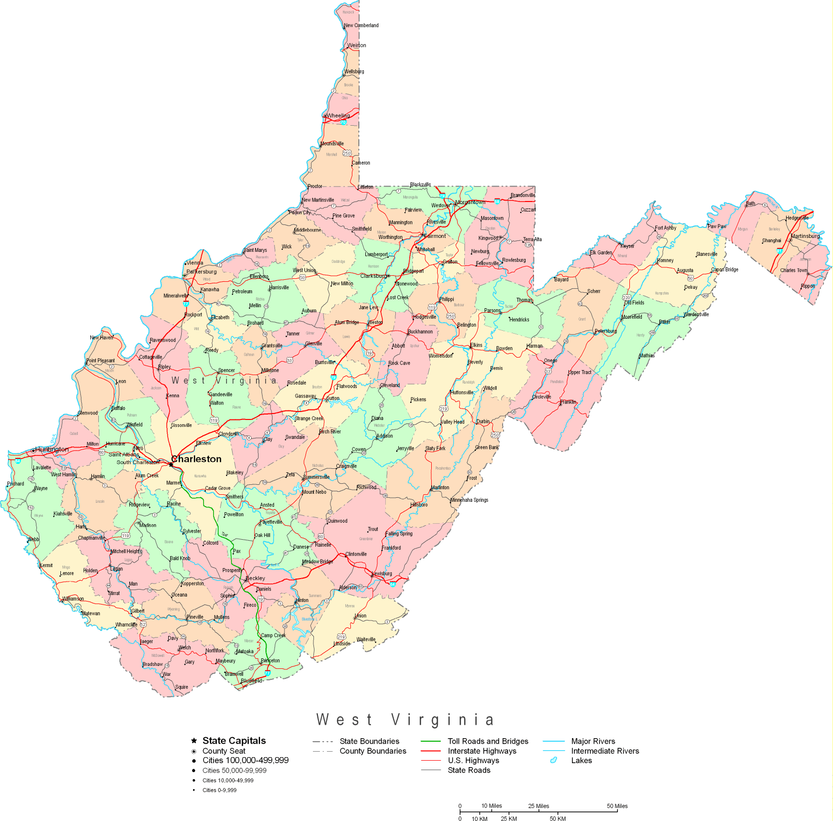
This image is a basic figure that shows the spatial layout of this environs with a basic variety of features.
You can use the map image and use it in your research. Providing a link to here is our request.
If you are hoping for aid finding a map, a different kind of map, or are hoping for a good tailor-made preparation, simply get in touch with us.
Procure good customized maps from us. A custom map made by us cover a wide array of elements, for example: dog tracks, scale bar, GPS coordinates, air navigation features, indian reserves, oceans, hamlets, or rivers, etc. Map types go from human geography to wall, digital to hardcopy, regions to state legislative districts.
Good maps are correct, all-encompassing, and not old. Fine map-making by YellowMaps.
To procure hardcopy maps, e.g. recreation atlases, maps for kids, or maps for kayaking, please explore our map shop We have a collection of thousands and thousands map items.
Fun fact about maps: the word 'map' comes from the Latin 'mappa mundi', meaning 'world on cloth'.
Back to State map collection