State Maps Home > State Map Collection > Pittsburgh Map
Street Map of Pittsburgh
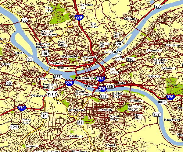
Above is a classic projection offering the spatial relationships of this territory with a basic collection of features.
You are granted permission to share this image and work with it in your projects. Linking back to this resource would be considerate and well thought of.
In the event you need assistance locating a map, a special kind of map, or need a suitable custom-made work, do not hesitate to get in touch with us.
Purchase tip-top custom maps from us. Custom maps made by YellowMaps cover a huge mixture of map components, e.g.: highways, elevation information, UTM coordinates, caves, indian reserves, towns, glaciers, or provinces, etc. Map types run from highway to wall, printable to printed, world to economic places.
Suitable maps are specific, all-encompassing, and not old. First-Rate cartography by YellowMaps.
To order paper maps, such as recreation atlases, world maps, or hiking maps, please do not hesitate to visit our map shop You can find thousands and thousands maps.
Have trouble printing or downloading this map? Just contact us.
Back to State map collection