State Maps Home > State Map Collection > Western Maryland Map
Printable Map of Western Maryland
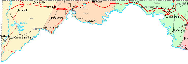
On top we have a plain representation that shows the features of this neck of the woods with a simple variety of map elements.
Of course, you may use this image and employ it for many purposes. Giving credit to this webpage would be considerate and well thought of.
On the assumption that you desire support finding a map, a different kind of map, or desire a great personalized concoction, simply email us.
Procure proper customized maps from us. A tailor-made product produced by us embrace a useful mixture of elements, for example: avenues, scale bar, UTM coordinates, bays, islands, territories, craters, or natural resources sites, etc. Map types range from road to city, printed to electronic, block groups to school districts.
Great maps are detailed, all-encompassing, and not obsolete. Finest map-making by YellowMaps.
To buy printed maps or charts, like navigational charts, tourist maps, or maps for kayaking, simply pay a visit to our online map shop It has more than 100,000 map products.
Contact us about international topographic maps too. We will try to get you any map that is currently in circulation.
Back to State map collection