State Maps Home > State Map Collection > Platte River Map - IMW
International Map of The World: Platte River: IMW-nk-14
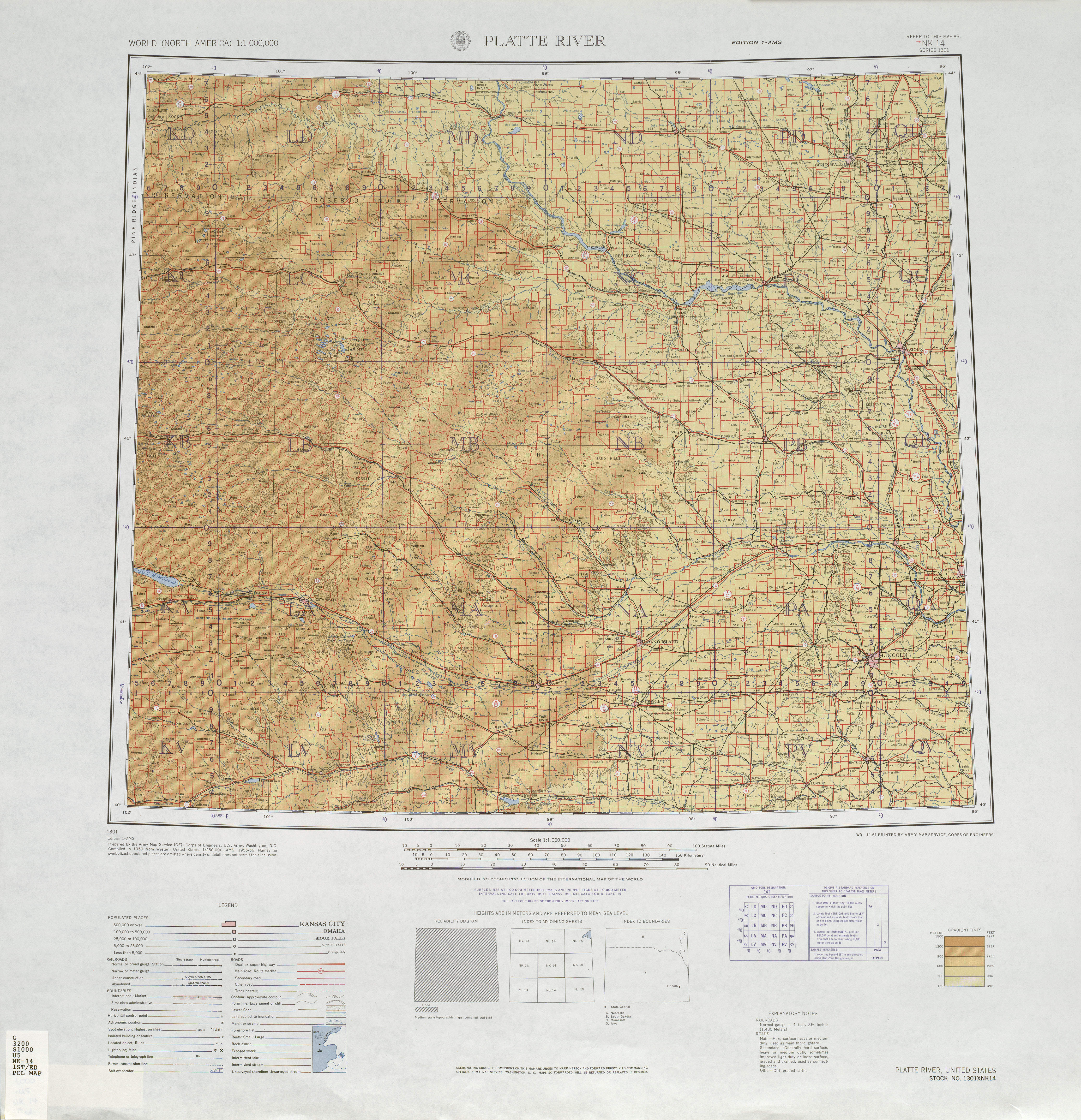
The image above is a simple diagram presenting the spatial relationships of this region with a classic array of elements.
You have permission to print this image and work with it in your work. Citing this page is always appreciated. Thank you.
On the assumption that you are hoping for support acquiring a map, a particular map, or are hoping for a high quality made-to-your-specs cartographic design, just contact our map specialists.
Procure good custom-built maps from us. A tailor-made product produced by us have a large selection of map elements, like: main arteries, scale bar, GPS coordinates, campsites, major municipal/district areas, seas, district municipalities, or natural resources sites, etc. Types of maps run from orienteering to land use, printed to electronic, states to urban areas.
High Quality maps are correct, complete, and not obsolete. First-Rate cartography by YellowMaps.
To order actual maps that get delivered in the mail to your home, like road atlases, state maps, or maps showing elevation, please go to our map store We have a collection of thousands and thousands map items.
Ever wondered why there are so many different maps around? Well, to cover the whole of North America at let's say 1:24,000 scale, you will need more than 100,000 maps. This would be millions of maps if you want to cover the whole earth at that scale. It's a big place!
Back to State map collection